
|
|
| You are here: ACACIA | Project E1 | Digital Atlas of Namibia | Overview | ||||||||||||||||||
|
|
 |
|
||||||||||||||||
|
|
We credit the Atlas of Namibia Project (2002) Directorate of Environmental Affairs, Ministry of Environment and Tourism (http://209.88.21.36/Atlas/Atlas_web.htm) as the direct source of the used information. |
|
|
|
|
Archaeological Records |
1.8m to 10,000 years ago |
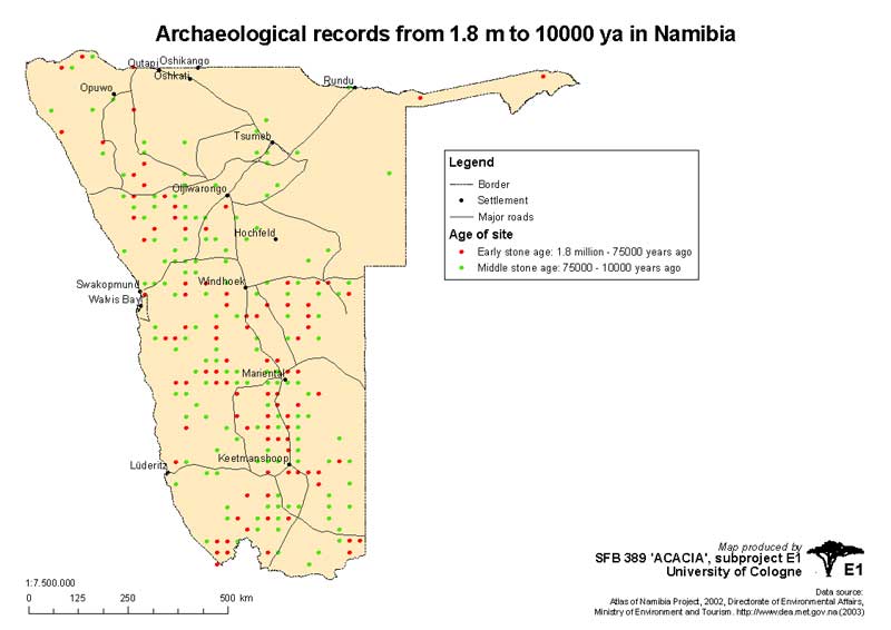 1.8m to 10,000 years ago |
|
|
|
ZIP-Archive contains:
|
||
|
10,000 to 2000 years ago |
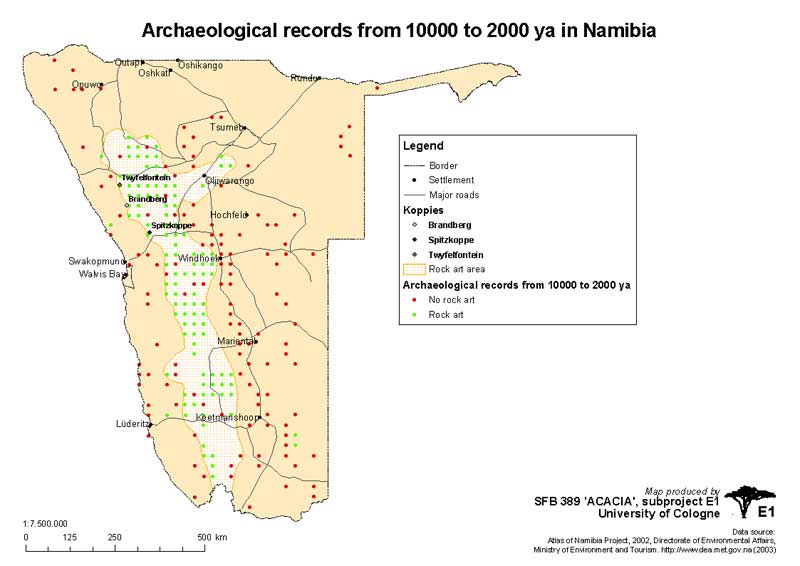 10,000 to 2000 years ago |
|
|
|
ZIP-Archive contains:
|
||
|
The last 2000 years |
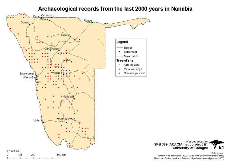 The last 2000 years |
|
|
|
ZIP-Archive contains:
|
||
|
|
|
|
|
Land Allocation |
Land Allocations (1902) |
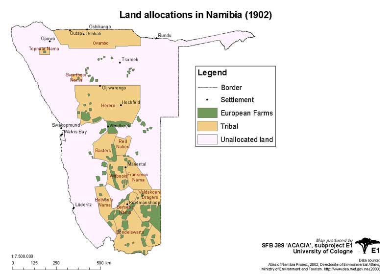 Land allocations in 1902 |
|
|
|
ZIP-Archive contains:
|
||
|
Land Allocations (1911) |
 Land allocations in 1911 |
|
|
|
ZIP-Archive contains:
|
||
|
Land Allocations (1921) |
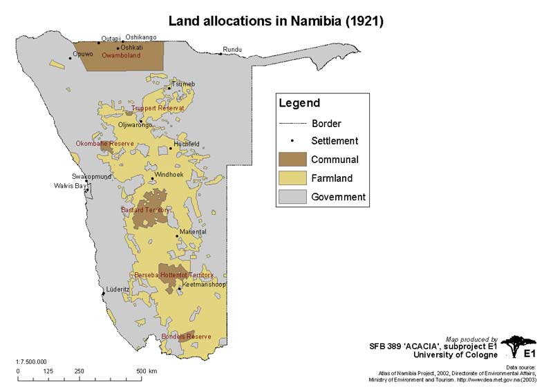 Land allocations in 1921 |
|
|
|
ZIP-Archive contains:
|
||
|
Land Allocations (1937) |
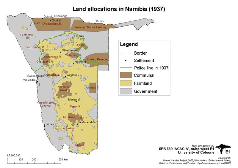 Land allocations in 1937 |
|
|
|
ZIP-Archive contains:
|
||
|
Land Allocations (1955) |
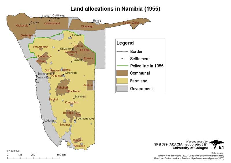 Land allocations in 1955 |
|
|
|
ZIP-Archive contains:
|
||
|
Land Allocations - Odendaal Proposals (1964) |
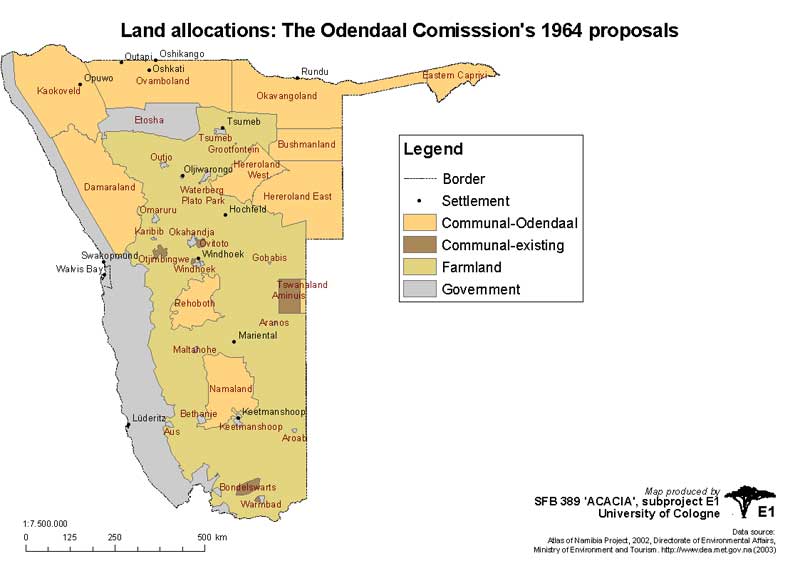 Land allocations in 1964 - Odendaal Proposals |
|
|
|
ZIP-Archive contains:
|
||
|
|
|
|
|
Land Control |
Control over Land |
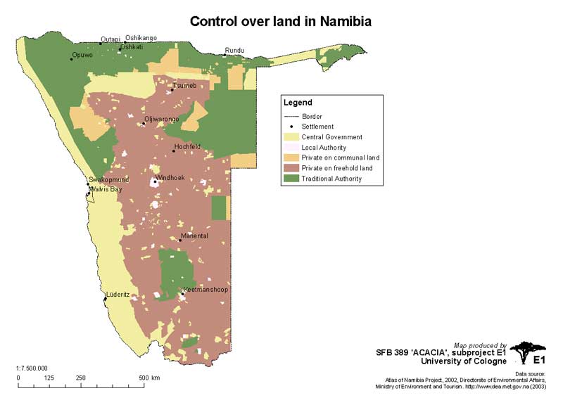 Control over Land |
|
|
|
ZIP-Archive contains:
|
||
|
|
|
|
|
Land Use |
Land Uses |
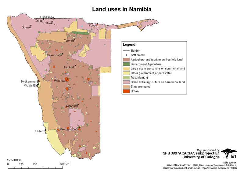 Control over Land |
|
|
|
ZIP-Archive contains:
|
||
|
Cattle Density |
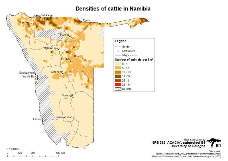 Cattle density |
|
|
|
ZIP-Archive contains:
|
||
|
Livestock Density |
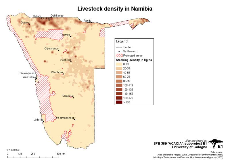 Livestock density |
|
|
|
ZIP-Archive contains:
|
||
|
Carrying Capacity |
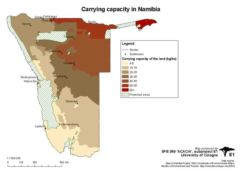 Carrying Capacity |
|
|
|
ZIP-Archive contains:
|
||
|
|
|
|
|
Local and regional government |
Local Government |
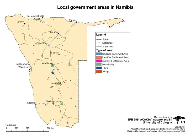 Local Government |
|
|
|
ZIP-Archive contains:
|
||
|
Regional Government |
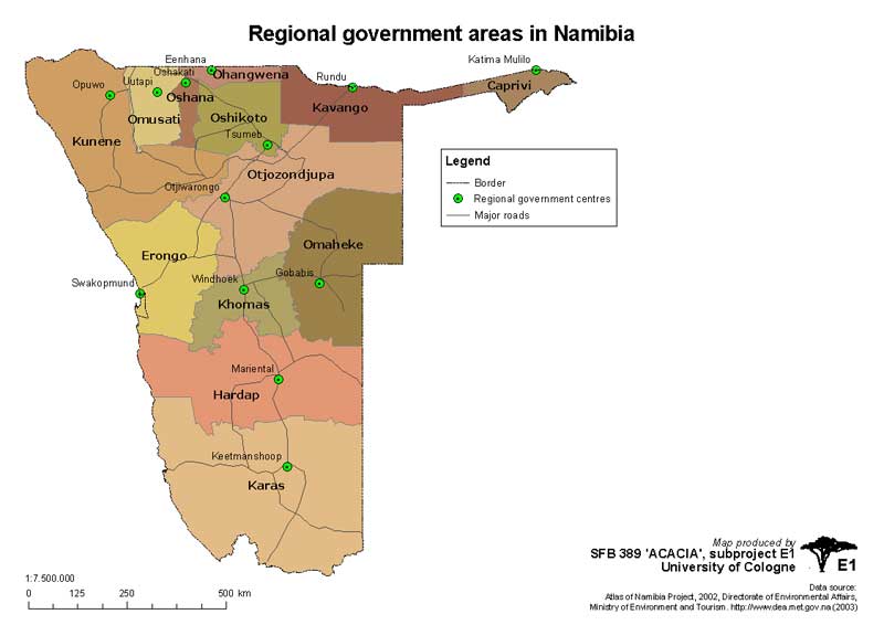 Regional Government |
|
|
|
ZIP-Archive contains:
|
||
|
|
|
|
|
Conservation Areas & Tourism |
Tourism Accommodation |
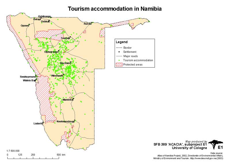 Tourism Accommodation |
|
|
|
ZIP-Archive contains:
|
||
|
Potentials for Tourism |
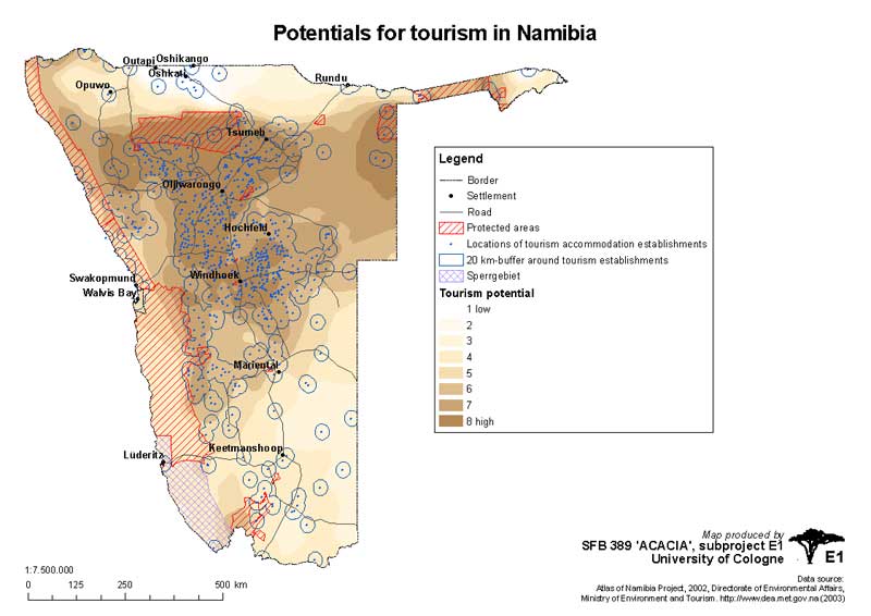 Potentials for Tourism |
|
|
|
ZIP-Archive contains:
|
||
|
Areas allocated and porposed for Conservation |
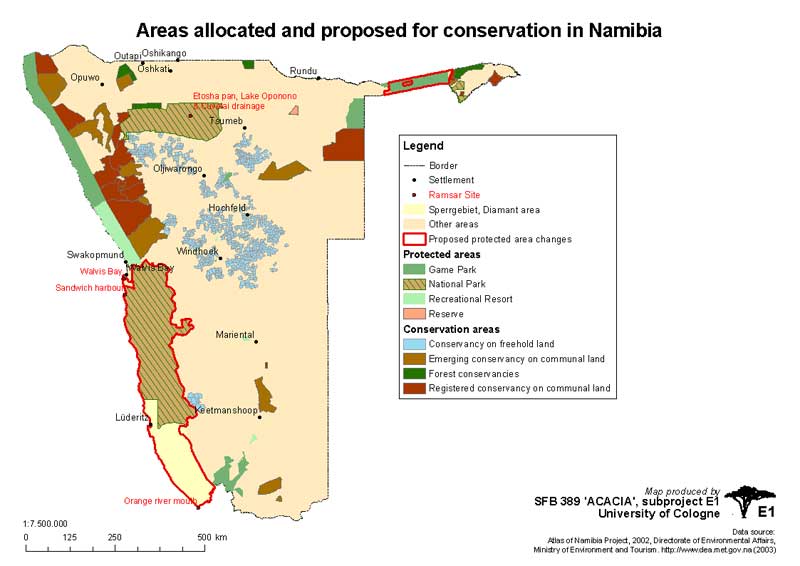 Areas allocated and porposed for Conservation |
|
|
|
ZIP-Archive contains:
|
||
|
|
|
|
|