|
|
| You are here: ACACIA | Project E1 | Digital Atlas of Namibia | Overview | ||||||||||||||||||
|
|
 |
|
||||||||||||||||
|
|
We credit the Atlas of Namibia Project (2002) Directorate of Environmental Affairs, Ministry of Environment and Tourism (http://209.88.21.36/Atlas/Atlas_web.htm) as the direct source of the used information. |
|
|
|
|
Elevations, Relief & Profiles |
Altitudinal Profiles |
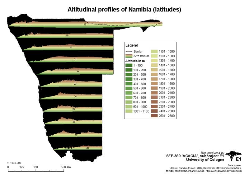 Altitudinal profiles of Namibia |
|
|
|
ZIP-Archive contains:
|
||
|
Elevations & Relief |
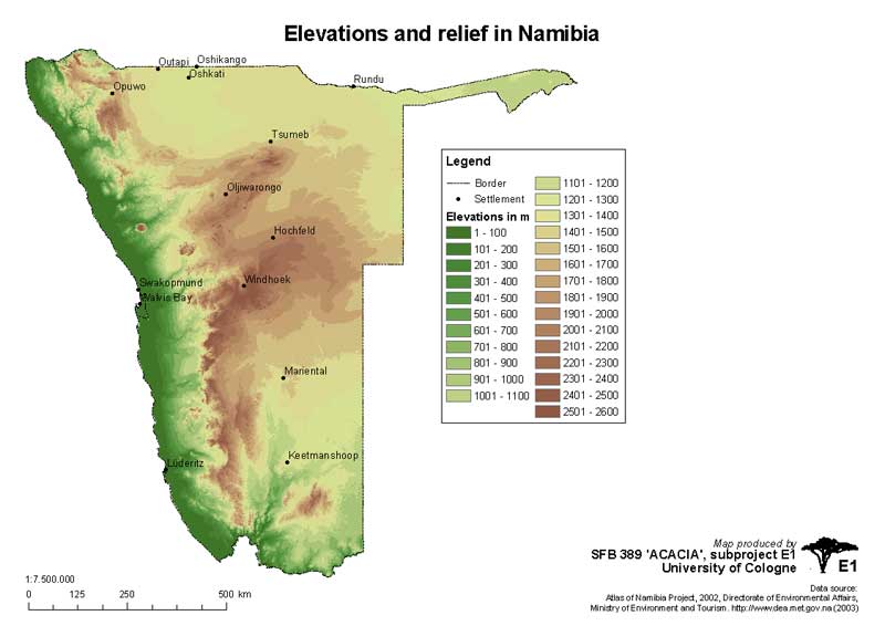 Elevations and relief in Namibia |
|
|
|
ZIP-Archive contains:
|
||
|
Landscapes |
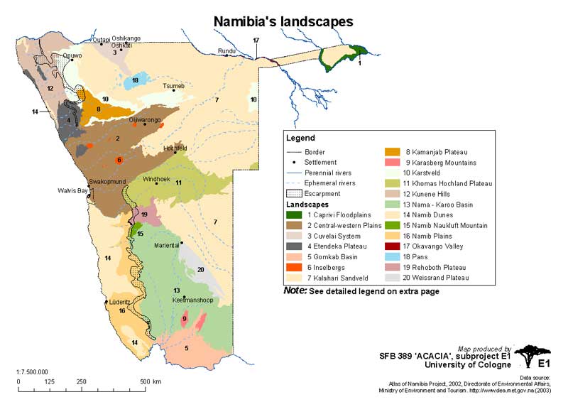 Landscapes |
|
|
|
ZIP-Archive contains:
|
||
|
|
|
|
|
Soils |
Dominant Soils |
 Dominant soils in Namibia |
|
|
|
ZIP-Archive contains:
|
||
|
Relative suitability of soils for crop cultivation |
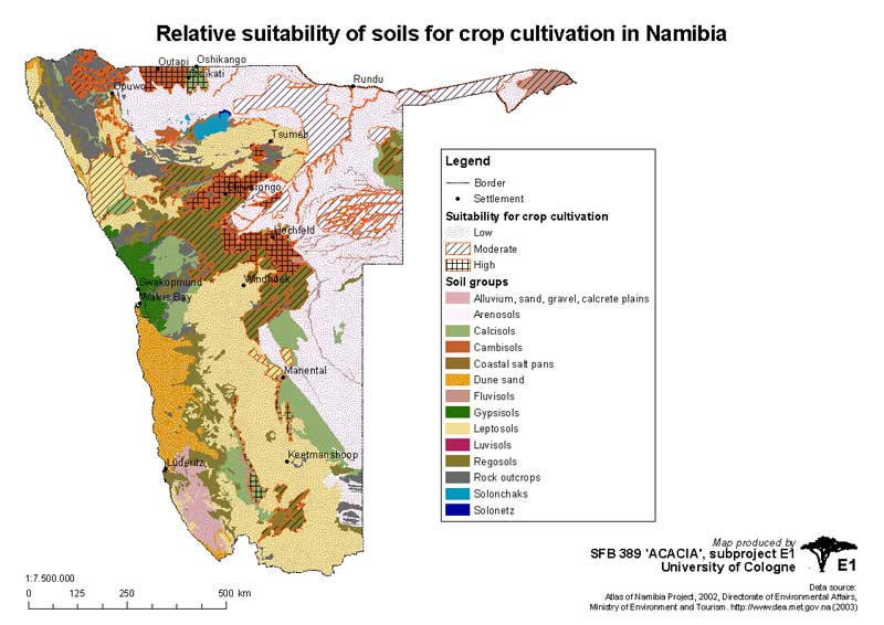 Relative suitability of soils for crop cultivation |
|
|
|
ZIP-Archive contains:
|
||
|
|
|
|
|
Geology |
Geology |
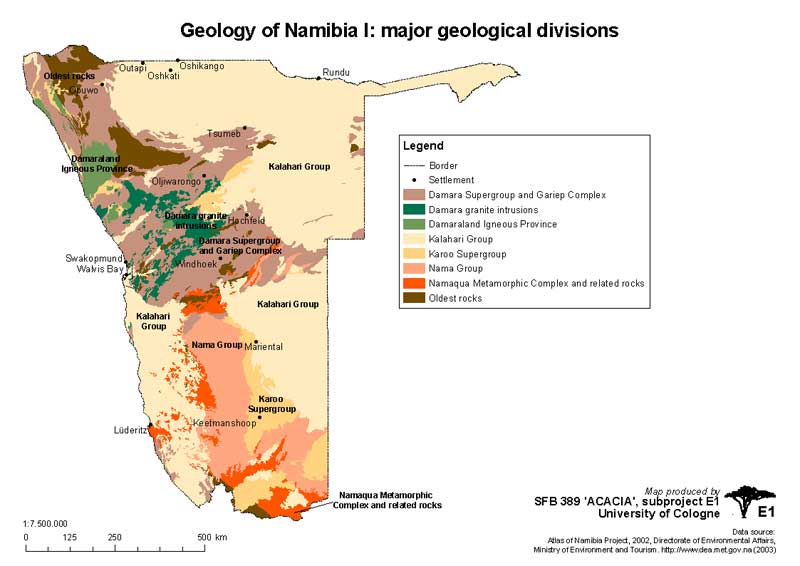 Geology of Namibia |
|
|
|
ZIP-Archive contains:
|
||
|
Kalahari & recent deserts |
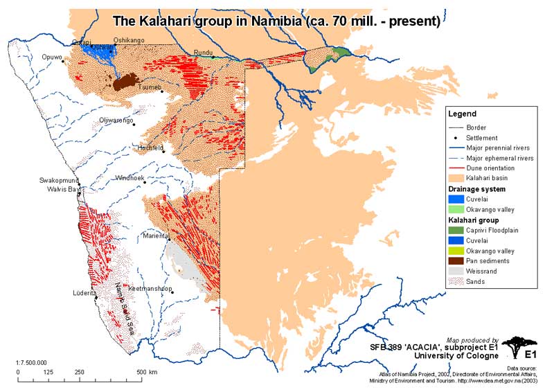 Kalahari & recent deserts |
|
|
|
ZIP-Archive contains:
|
||
|
|
|
|
|
Aquifers |
Groundwater Basins |
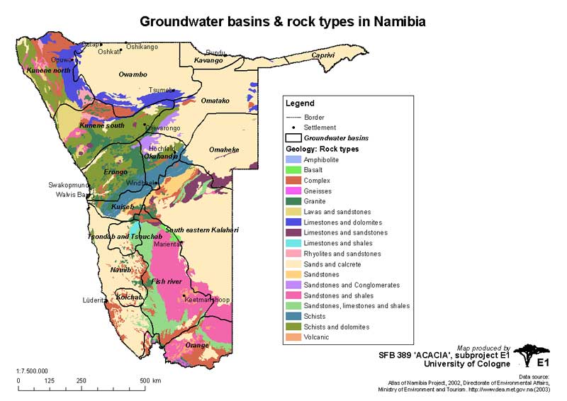 Groundwater Basins |
|
|
|
ZIP-Archive contains:
|
||
|
|
|
|
|
Rivers |
Rivers, basins, pans and lakes |
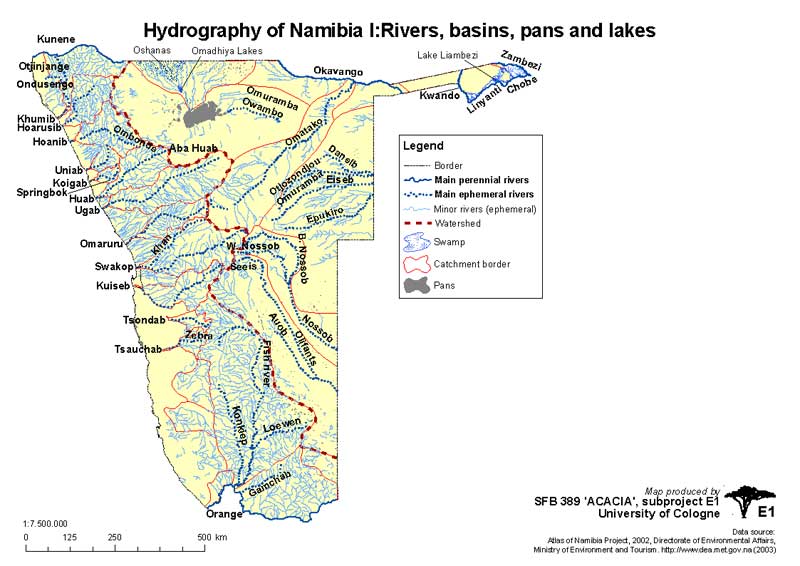 Rivers, basins, pans and lakes |
|
|
|
ZIP-Archive contains:
|
||
|
Perennial river basins and the Cuvelai System |
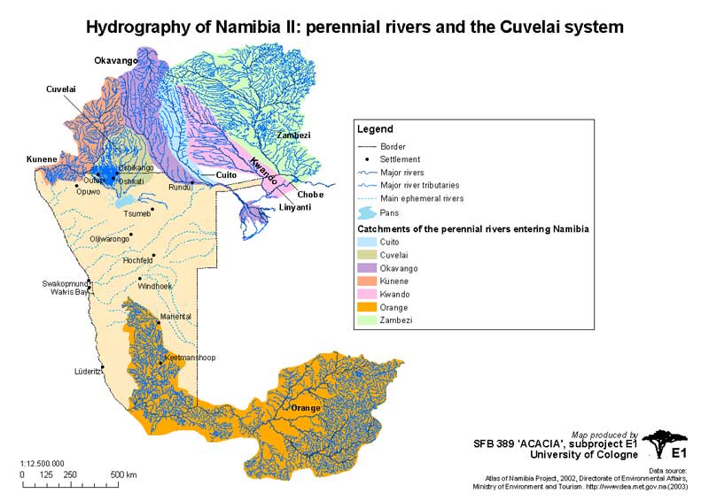 Perennial river basins and the Cuvelai System |
|
|
|
ZIP-Archive contains:
|
||
|
|
|
|
|
Mining & Mineral Resources |
Mineral Deposit |
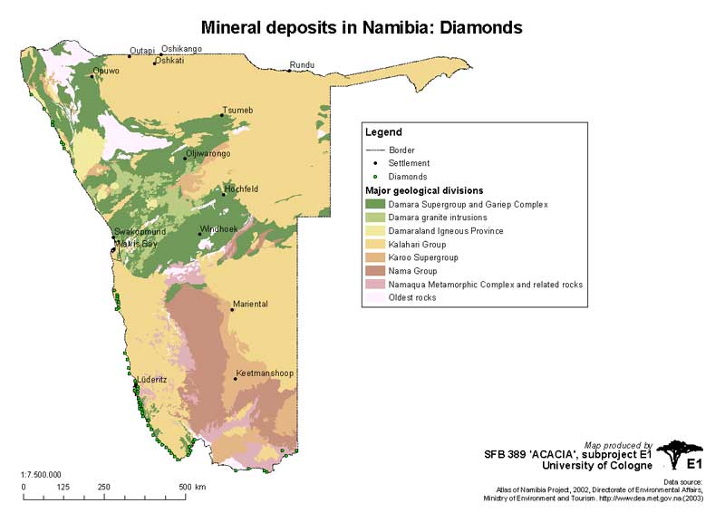 Mineral Deposit |
|
|
|
ZIP-Archive contains:
|
||
|
|
|
|
|