
|
|
|
Project Leader:
|
Researchers: Students:
|
|
|||||||
Publications
News:
19-06-2008 Atlas of Cultural and Environmental Change in Arid Africa (update) - Flash Demo 16-04-2007 Atlas of Cultural and Environmental Change in Arid Africa 13-12-2004 Use of high resolution satellite data in SFB 389 - Introdution in QuickBird-data (PDF) 26-06-2004 Digital Atlas of Namibia - Interaktiv Version (Beta-Test) 19-03-2004
Digital Atlas of Namibia 14-08-2003 Poster Poznan Symposium 14-17 July, 2003 (PDF-File) 01-08-2003
Online-Artikel in ArcNews (Vol.25/No.2):
In Egypt, Sudan, and Namibia, GIS Helps Compare Human Strategies of Coping With Arid Habitats12-03-2003 Multidisciplinary project cooperation (UPDATES: 16-03-2003 / 07-05-2003) 02-12-2002 Statusoverview Project E1 - Colloquium Africanum 26-11-2002 (MS-PowerPoint-Presentation) 04-11-2002 Climate Maps (Examples) North-/Southafrica
The aim of the Project is a systematic compilation, analysis, comparison, and presentation of climate and vegetation data, in order to reconstruct the holocene human land use potential in the arid southwestern and northeastern Africa. The steps described are similar to the functions of modern geographical information systems which are able to import, manage, analyse, and represent spatial data. The main focus is to characterize and establish the reasons for the desiccation, desertification, and/or the degradation of the holocene environment.
The project can be divided into three conceptual and operational phases (s. Figure):
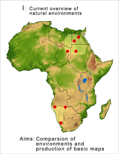 (click to enlarge) |
|
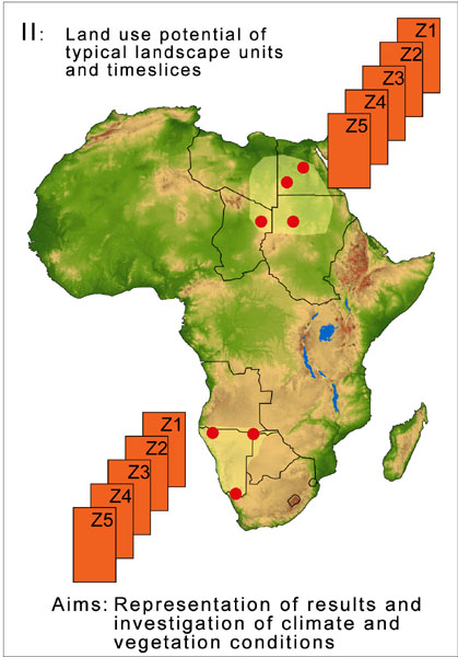 (click to enlarge) |
|
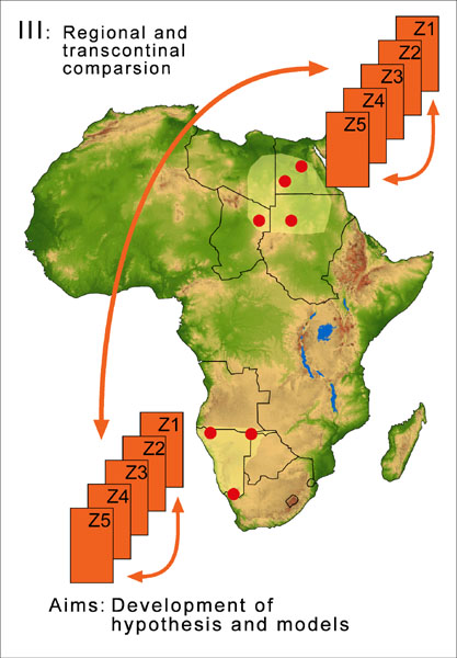 (click to enlarge) |
|
Relevant Internetpages:
www.geographie.uni-koeln.de
www.portal.uni-koeln.de/sfb.html
www.uni-koeln.de/sfb389
| [Main] [Project E1] [Project E2] [Project E3] |